
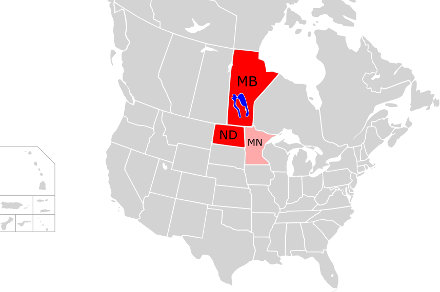
Manitoba • North Dakota • (Minnesota)


Manitoba – one Province is still missing
This is our eighth trip to Canada, and exactly one province is still missing in our collection: Manitoba, “The Keystone State”. Since the easternmost of the Canadian prairie provinces does not offer enough highlights for a three-week round-trip, half of this tour will take us through North Dakota, the bordering U.S. state to the south, which we have also never traveled to.
We begin our journey north of Winnipeg, the capital of Manitoba. The historic bridge at Lockport is currently under repair; this is where the Red River meets the Red River Floodway, the canal that runs around the city and is intended to protect it from flooding. Lower Fort Garry is the first National Historic Site we will encounter on this journey. On Lake Winnipeg, we spend the night in Gimli, a small town with Icelandic heritage.
The next day we cross the solitude of the Interlake Region, the area between the two great lakes, Lake Winnipeg and Lake Manitoba. A narrow passage between the east and west banks is connected by a bridge, “The Narrows”, and takes us to Dauphin, the gateway to Riding Mountain National Park. It is the only national park in the south of this huge province.
Via Brandon, Manitoba’s second largest city, our route winds its way through Spruce Woods Provincial Park and the small town of Souris to Boissevain in the Turtle Mountains far south. From here it’s just 25 km to the International Peace Garden, the only park in North America shared by Canada and the United States. You can get in without any control; however, upon leaving the park, either the Canadian or the American border control awaits you with all its formalities, depending on whether you turn left or right.
Welcome to North Dakota
We have decided to turn right, and after answering a few questions (“no, we don’t have any drugs or weapons with us”) we are in North Dakota. Just across the border, in Dunseith, there is a huge turtle made of car rims; a little later we reach Rugby, the geographical center of North America. Our first night on this trip in the USA we spend in Minot, supply center in the north of the state.
The following day we reach Lake Sakakawea, a reservoir formed by damming the Missouri River to the second largest reservoir in the U.S. in terms of surface. A detour to Little Missouri State Park takes us to the colorful scenery of the Badlands, which we already know from our visit to South Dakota.


The landscape in the northwest of the state is strongly shaped by oil production. The Bakken oil field has catapulted North Dakota to second place among the oil-producing states in the USA in just a few years; only Texas currently produces more oil. It’s no surprise, then, that the towns of Watford City and Williston almost doubled their population in the last decade; an international airport even opened near Williston in 2019.
With all the oil boom, one almost forgets that there are some important historic sites located here too: the Fairview Lift Bridge (raised only once, during its functional test), Fort Buford at the confluence of the Yellowstone and Missouri Rivers and – already located a few yards in the state of Montana – Fort Union Trading Post.
Highlight of our trip through North Dakota is a visit to Theodore Roosevelt National Park. In addition to the fascinating landscape, we enjoy the trusting prairie dogs in the Northern Unit, while several herds of bison populate the prairie (and partly also the road) in the South Unit. Medora and Dickinson serve as starting points for day trips into the park.
There would be no need to drive any further south if it weren’t for the Enchanted Highway. There are eight huge sculptures along this 32-mile-long road, some of which are more than 20 meters high, making driving on this road a truly magical experience. Via New Leipzig (Oktoberfest is being celebrated here with lots of pumpkins) and New Salem with “Salem Sue”, the world’s largest Holstein cow, we approach Lake Sakakawea once again and spend a day walking in the footsteps of Lewis & Clark, who once explored the way to the west. Via Garrison Dam we reach the Lewis and Clark Interpretive Center and Fort Mandan and finally Bismarck, small capital of North Dakota.
Through Minnesota back to Winnipeg
The next stops on the way east are the cities of Jamestown (with the world’s largest bison statue and the National Bison Museum) and Fargo, the largest city in North Dakota. Moorhead on the east bank of the Red River is Fargo’s sister city; so we quite unexpectedly come to our first trip to the state of Minnesota. Buffalo River State Park is located here, and since we want to head north anyway, we might as well drive through Minnesota’s Red Lake County.
One last time we head to North Dakota and to the city of Grand Forks, then we ride through the loneliness of Minnesota back to Manitoba. On the Trans-Canada Highway we visit the Centre of Canada Park (the middle of Canada between east and west coast) and finally return to Winnipeg, where we spend the last three days of this tour.
Route Description
| Tag/Day | Von/From | Nach/To | Route |
|---|---|---|---|
| 01 | Winnipeg Airport (YWG) | Winnipeg | 000 m / 010 km |
| 02 | Winnipeg | Gimli | 000 m / 120 km |
| 03 | Gimli | Dauphin | 000 m / 380 km |
| 04 | Dauphin | Brandon | 000 m / 180 km |
| 05 | Brandon | Boissevain | 000 m / 240 km |
| 06 | Boissevain (MB) | Minot (ND) | 000 m / 210 km |
| 07 | Minot | Watford City | 205 m / 330 km |
| 08 | Watford City | Williston | 100 m / 160 km |
| 09 | Williston | Dickinson | 180 m / 290 km |
| 10 | Dickinson | Dickinson | 135 m / 215 km |
| 11 | Dickinson | Beulah | 195 m / 315 km |
| 12 | Beulah | Bismarck | 130 m / 210 km |
| 13 | Bismarck | Bismarck | 025 m / 040 km |
| 14 | Bismarck | Jamestown | 140 m / 225 km |
| 15 | Jamestown | Fargo | 115 m / 185 km |
| 16 | Fargo | Fargo | 020 m / 030 km |
| 17 | Fargo | Grand Forks | 155 m / 250 km |
| 18 | Grand Forks (ND) | Winnipeg (MB) | 185 m / 300 km |
| 19 | Winnipeg | Winnipeg | 000 m / 000 km |
| 20 | Winnipeg | Winnipeg | 000 m / 000 km |
| 21 | Winnipeg | Winnipeg Airport (YWG) | 000 m / 000 km |
| Total | 000 m / 3.690 km |
The Journey in Pictures


Mit 604 Fuß die längste Hängebrücke Kanadas – 7 Fuß länger
als die Brücke an Eagle Canyon, die sich fälschlicherweise mit diesem Titel schmückt


Die weltgrößte Holstein-Kuh

Ganz schön viele Kirchen für 3.000 Einwohner


