
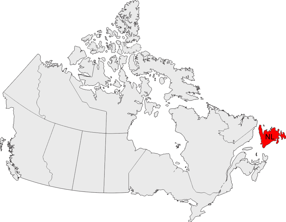
Newfoundland

Why Newfoundland?
Newfoundland is located in the Gulf of St. Lawrence and is a very large island, covering one third of the area of Germany. However, only half a million people live here – 180,000 of them in the greater area of the capital St. John’s. With 20,000 inhabitants, Corner Brook is the largest city in the west of the island, and Gander, known for its international airport, has a population of 10,000.
You don’t go to Newfoundland for sightseeing, and certainly not to party. People come to this island mainly for its unique character, shaped by the sea. Huge forests and countless bays invite visitors to discover the island’s solitude again and again. Newfoundland has around 10,000 kilometers of coastline; the small villages have been influenced by fishing for centuries. If you’re lucky, you might see caribou or puffins, and in summer visitors wait for the giants of the north – icebergs and whales. And another figure: the population of moose is estimated at over 120,000, the largest population of moose in all of North America.
Westbound
Newfoundland can be reached either by ferry (from Sydney in Nova Scotia to Port aux Basques or Argentia) or by plane. We decided to take the plane; our journey begins at St. John’s International Airport, which is less than a six-hour flight from Europe. There is no way to get lost – there’s only one main road, and that is the Trans-Canada Highway (TCH).


It’s about 800 kilometers to our first highlight, the Gros Morne National Park on the west coast, and we want to cover that distance with only one overnight stay. So Arnold’s Cove, Gambo, Lewisporte and Bishop’s Falls are just small towns to take a break. In Springdale, a little off the highway, there is at least a Tim Hortons, Canada’s national coffee house chain.
The last major town before we reach the coast is Deer Lake – ideal for refueling and refilling food. Once again, we head east for just an hour; our accommodation in the northern part of the national park is in Rocky Harbour where we spend the next three nights in the brand new “Augustus Jane Inn”. In the southern part of the park, we will rent a cottage in Trout River for another two nights.
Eastbound
On our way back we take some detours to the coast. First destination, again via Deer Lake and Springdale, is King’s Point. Here we enjoy the award-winning Alexander Murray Hiking Trail, a premium hiking highlight. More than 2,200 steps must be climbed on the four-hour trail. After the next loop on the TCH we reach Grand Falls-Windsor, the largest city in the interior. Shortly thereafter we turn north; destinations are the two islands of Twillingate and Fogo Island. Above all, the Art Studios located on the cliffs on the coast and Todd Saunders’ Fogo Island Inn are absolute musts on this trip.
The route takes us back via Gander, known for its major international airport, which, after an eventful history, now registers no more than 20 domestic flights per day. Via Terra Nova National Park, we continue to Clarenville, starting point for a round trip over historic Bonavista Peninsula. This is also where the Skerwink Trail is located, a premium hiking trail that runs for about 5 kilometers high above the sea and offers magnificent views.
The last part of our journey takes us around the Avalon Peninsula. Via Trepassey in the very south we pass the Colony of Avalon in Ferryland and La Manche Provincial Park with an incredible suspension bridge. Back in St. John’s, we explore a very interesting and colorful city. Finally, don’t miss the lighthouse of Cape Spear which marks the easternmost point of the North American continent.
Route Description
| Tag/Day | Von/From | Nach/To | Route |
|---|---|---|---|
| 01 | St. John's Airport (YYT) | St. John's | 020 km |
| 02 | St. John's | Lewisporte | 420 km |
| 03 | Lewisporte | Rocky Harbour | 360 km |
| 04 | Rocky Harbour | Rocky Harbour | 050 km |
| 05 | Rocky Harbour | Rocky Harbour | 050 km |
| 06 | Rocky Harbour | Trout River | 100 km |
| 07 | Trout River | Trout River | 050 km |
| 08 | Trout River | King's Point | 240 km |
| 09 | King's Point | Grand Falls-Windsor | 110 km |
| 10 | Grand Falls-Windsor | Twillingate | 160 km |
| 11 | Twillingate | Twillingate | 050 km |
| 12 | Twillingate | Fogo Island | 110 km |
| 13 | Fogo Island | Gander | 130 km |
| 14 | Gander | Clarenville | 160 km |
| 15 | Clarenville | Bonaventure | 280 km |
| 16 | Clarenville | Holyrood | 220 km |
| 17 | Holyrood | Trepassey | 110 km |
| 18 | Trepassey | St. John's | 150 km |
| 19 | St. John's | St. John's | 020 km |
| 20 | St. John's | St. John's | 050 km |
| 21 | St. John's | St. John's Airport (YYT) | 020 km |
| Total | 2.860 km |
The Journey in Pictures


Lobster Cove Head

Norris Point

Norris Point

Gipfel des Lookout Hills Trails

Die Tablelands zeichnen sich durch die geologische Besonderheit aus,
dass das Gestein des Erdmantels hier bis an die Erdoberfläche gehoben wurde


Der Italiener Giovanni Caboto gilt als der europäische Entdecker Neufundlands


Originally the “Capital” of Newfoundland

Im Sommer bieten die Betreiber des Leuchtturms ein “Lighthouse Picnic” an –
Essen, Trinken, Geschirr und Picknickdecke inklusive. Gegessen wird auf den Felsen an der Küste.


Skurrile Wallfahrtsstätte in the Middle of Nowhere